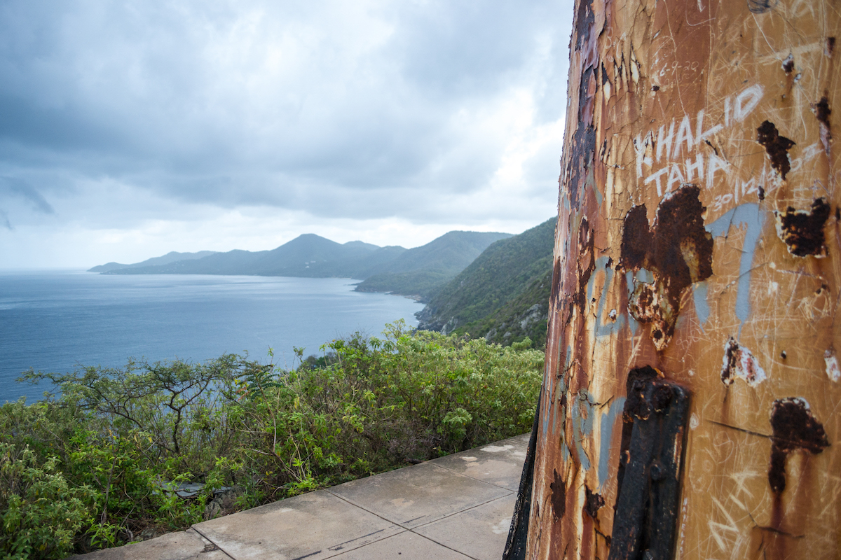
The US Virgin Islands are full of beautiful landscapes and turquoise beaches. St. Croix is the largest of the US Virgin Islands and is fairly mountainous, which means you’ll have the opportunity to get some great views of the coastline. This island is a little more rugged and adventurous with some very scenic areas to visit and some great hikes. Hiking to Hams Bluff Lighthouse in St. Croix was one of our favorites, though we enjoyed all of them.
The other hikes in St. Croix are worth doing as well and each one leads you to a different destination for the most part. The hike to the Annaly Bay Tide Pools takes you through the jungle to a rocky beach with tide pools.
The hike to Jack’s Bay and Isaac’s Bay takes you along the desert-like coastline to two beautiful beaches and bays. And there’s another hike nearby there called Goat’s Hill that gives you a great view of the mountains and surrounding area.
If you’re looking to do some hiking in St. Croix, Hams Bluff is a great spot to go.
Hike Details:
- Length: 1.6 miles RT
- Difficulty: Easy to Moderate
- Trail: Out and back
- Time: about an hour
About Hams Bluff Lighthouse
The Hams Bluff Lighthouse is an old structure that was built by the Danish in the early 1900s. It dates back to 1913 when construction first began and was finished in 1915. The lighthouse sits about 360 feet above sea level and has great views of the island’s coastline.
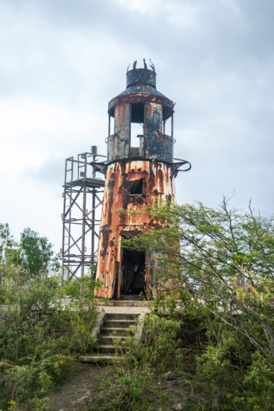
It was an operational lighthouse up until the mid-1990s when it was deactivated. Unfortunately, it has been in a state of deterioration ever since.
How to Get to Hams Bluff Lighthouse
Hams Bluff Lighthouse is located on the Northwest corner of the island. We headed that way after exploring some of the things to do in St. Croix on the west side. Frederiksted, Sandy Point National Wildlife Refuge (though it was closed when we went) and Rainbow Beach.
The hike itself it short and sweet with a slight incline. The road to the hike is a different story. There are some pretty major potholes to navigate. It had been raining off and on so the potholes were filled with water and it was impossible to tell how deep they were until you hit them.
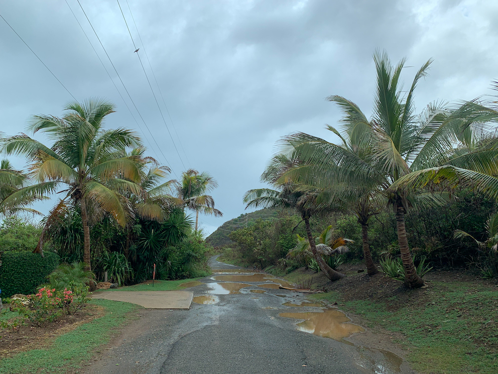
We had a Jeep so it wasn’t a concern for us but we did see people in a mini van who presumably turned around. There were several spots that were questionable for regular cars. I’d recommend having a car that can handle the road to reach this hike.
The Abandoned Building
You’ll be driving up HWY 63 along the coastline which is also called Hams Bluff Road. It forks at some point and you’ll take the left to follow along the coast until you start heading up the hill. You’ll be looking for a white, abandoned building with broken security systems and fences along the drive. We were later told that it was once a military building.
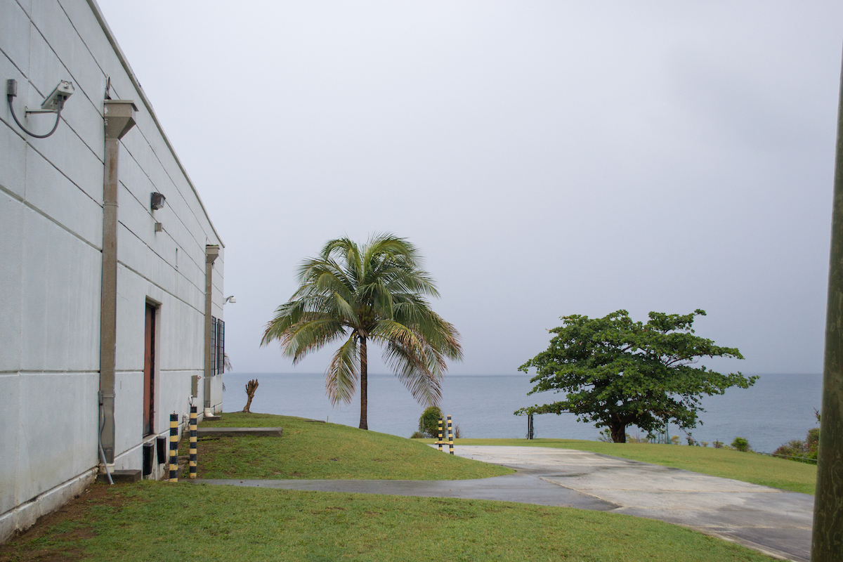
It felt a little like trespassing. We 100% thought we were in the wrong place even though the Maps app told us otherwise. The building has a garage opening that sort of looked like something out of The Walking Dead. It was pitch black inside with broken glass on the floor and garbage strewn about. It felt like something could be lurking in the corner.
As luck would have it, as soon as we got up the drive, it started to rain heavily and we didn’t have the top up on our Jeep. So into the dark garage we went.
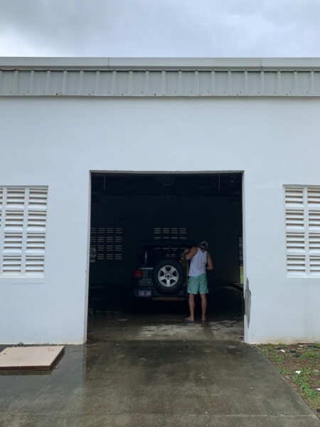
The rain showed no sign of letting up so we decided to just wait it out in the pitch black garage. You could hardly even see the corners of the room.
Now here’s some irony: I am not someone who can nap. I could be dead to the world but would lie there in misery unable to actually fall asleep. But here, HERE is where my body decides is a good place to nap. In a car with no roof that’s parked inside this dark, dingy, abandoned building that doesn’t quite make you feel safe. It makes ZERO sense, but it was one of the best naps I’ve ever had and I was out for the entire time that it rained.
The Trailhead
When the rain stopped and my husband had awoken me from my deep slumber, we decided to come back later because we figured the trail would be a muddy mess.
However, we took a wrong turn and ended up at a construction site and the people there told us the trail would probably be fine. So we went back up, decided to park back in the garage in case it rained again and found the trailhead.
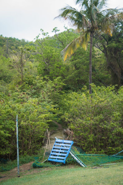
The trailhead is opposite from the garage near the tree line and marked by a torn down fence with a blue painted sign. There’s enough of a concrete area to park your car as well. We didn’t have any issues but we had been told to leave our car unlocked (no broken glass) and to not keep anything valuable inside at some of the hikes that are more secluded.
Hiking the Hams Bluff Trail
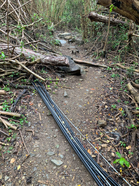
The hike is not very hard and is a quick 25 minutes or so to the top with a slight elevation. One thing you’ll notice though is that there are downed power lines on the trail. They have evidently been here for awhile and supposedly don’t pose any danger but we were still weary of them and avoided them while hiking. And if it was dangerous, they would have closed off the trail.
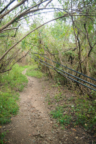
Some of them are hanging down, some have been covered by downed trees, some seem to have become one with nature. We just walked over and around them.
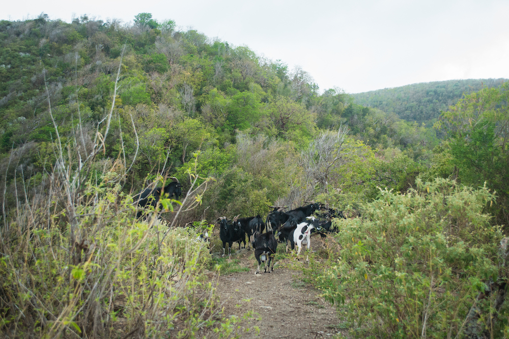
Once you get near the top, you might start to hear some noises and if you’re not prepared for it, it might startle you. At the top of the hill is where you’ll find the resident goats! There’s a whole group of them that tend to stay in this area. You’ll see the lighthouse on the left and the goats will be meandering on the right where the trail continues along.
The Lighthouse
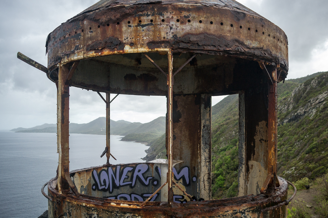
The lighthouse is not very large and is pretty dilapidated and rusted over. You can go inside it and there is a ladder that will take you up to the top. However, do so at your own risk. The second floor looked pretty rusted over as well so we opted for not going up it.
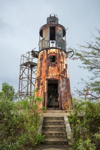
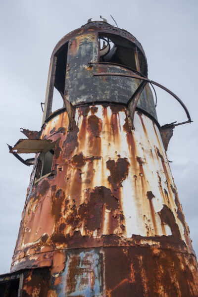
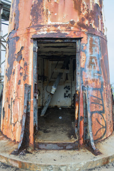
However, there IS a scaffolding right next to it that you can climb. It’s bolted to the cement and felt about 25% safer, so we decided to climb it instead. I’m not quite sure why it was put in, but it gives you the same view, if not better.
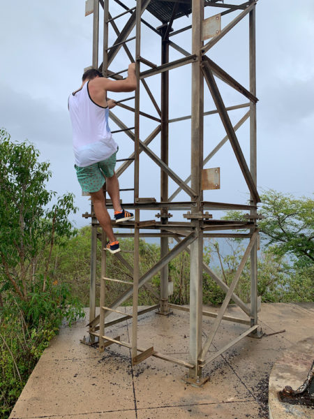
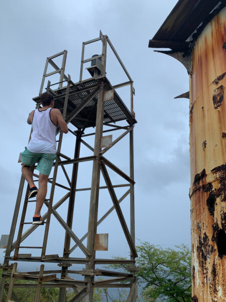
The scaffolding is pretty level with the top of the lighthouse and lets you get the lighthouse IN the picture. It has a pretty cool vantage point of the lighthouse, but it definitely felt a little unstable. Watch your footing on the scaffolding as some of the floor grates moved a little bit.
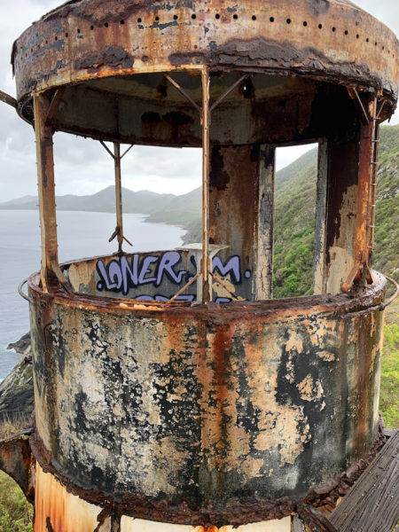
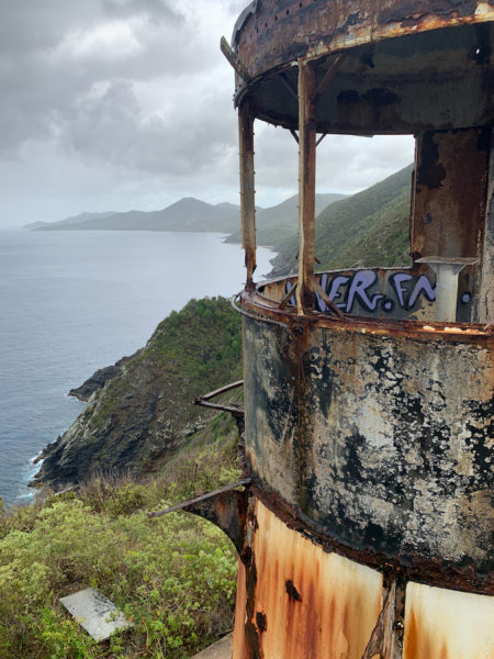
Even if you don’t decide to go up either, you’ll still get beautiful views of the rocky coastline. If we had thought ahead, we would have brought a picnic lunch because it was a great little spot to enjoy.
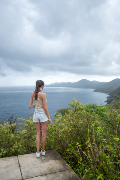
We also had the hike almost entirely to ourselves. Since it was right after it rained, there was no one on the trail on our way up. Only when we started the hike down did we start to see some people. And the first people we ran into asked us if it was our car that was parked in the building ha.
Best Time to Go
The good thing about this trail is that it is covered by trees for most of the hike. You shouldn’t have to worry about the heat of the day too much as the only part that is really exposed is the top. It is on the west side of the island so it would be a good hike to do near sundown.
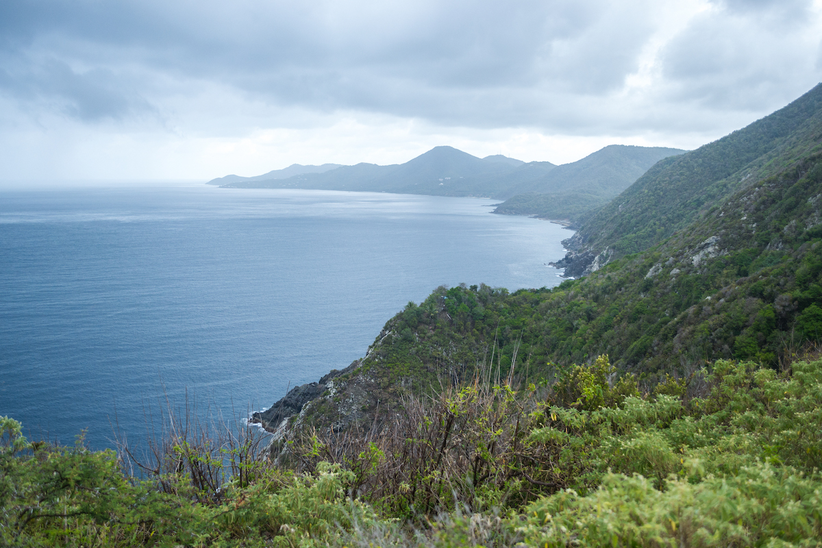
We did this hike right after a downpour and like the construction guys said, it was fine. Surprisingly it wasn’t muddy and it was actually cooled off at that time.
What to Bring
Because the hike is fairly short, you don’t have to bring much.
- Tennis shoes
- Water bottle
- Phone/camera
Is it worth doing? Yes! We always like to find hikes to do when we travel and love when they have good views. This is a fun, easy hike and we enjoyed exploring the area.
Read More:
PIN IT FOR LATER




Leave a Reply