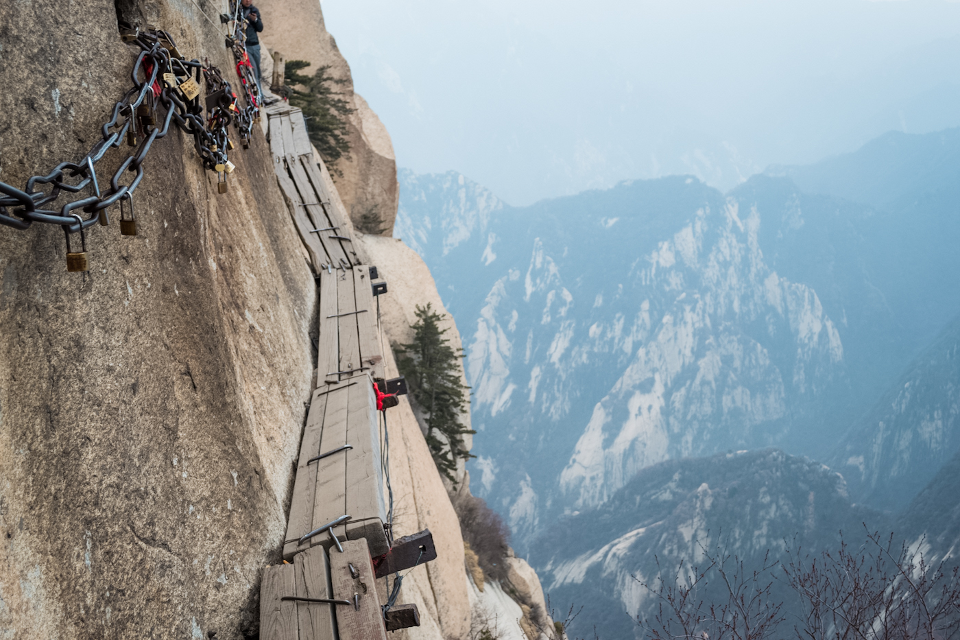
The Plank Walk at Mount Huashan in China had a viral stint in which it was deemed ‘The World’s Most Dangerous Hiking Trail’ by the internet jurists, which naturally compelled me to file it under ‘bucket list‘.
After reading several of these articles online, I was under the impression that you had to face the infamous plank walk if you wanted to climb Mount Huashan at all and that at the end of a strenuous, life-threatening hike across boards and pegs, you would be able to say that it was all for a cup of tea.
So what’s the Plank Walk at Mount Huashan REALLY like? And is it all so you can reach this tiny little tea house?! The internet made it seem like this crazy hike led you to a small hut on the edge of a cliff that only the slightly insane would reach.
I had so many questions.
It wasn’t until I moved to China that I started seriously considering going. Bucket list items tend to stay unchecked after all. I wasn’t sure where this place even was and if it was even that accessible.
So when my mom and sister told me they were going to come visit and wanted to travel up to Beijing and Xi’an, I sneakily suggested a “really cool mountain nearby with lots of great hikes and views”. (I had to sell them on the mountain of course, in case neither one of them wanted to do the plank walk–which I anticipated.)
After doing some research themselves, it was added to our northern China itinerary. And then I told them about the plank walk.
(If you’re only interested in the Plank Walk, you’ll want to scroll down a ways, but the rest of the mountain is pretty fascinating too.)
About Mount Huashan
Mount Huashan is one of the 5 Sacred Mountains (or 5 Great Mountains) in China and is located just outside of Xi’an in Shaanxi Province. These mountains are some of the most famous in China and have been the location of imperial pilgrimage by emperors throughout history.
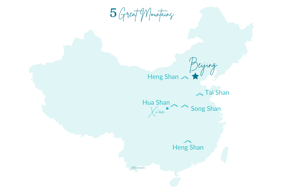
The name Mount Huashan translates to “flower mountain” as the peaks were said to resemble the shape of a lotus flower. It’s also referred to as Mount Hua or just Huashan. (‘shan’ means mountain or mount in Mandarin, so it’s redundant calling it Mount Huashan, but my Mandarin hardly passed survival status so I’m not very qualified on the matter.) Anyway, most people call it one of the above.
Mount Huashan has 5 peaks that can be explored with the Plank Walk being only a small part of the mountain. And while it is considered a dangerous hike, the rest of the mountain can’t be overlooked. The mountain consists of sheer drop offs, 90º angle stairs and cliff-side buildings. And…the Plank Walk isn’t the only fear-inducing hike you can do.
How to Get There
Mount Huashan is located in the town of Huayin which is about an hour and a half away from Xi’an. There are people who say you can do it as a day trip, but if you’re traveling on your own, I’d advise against it.
Why? Something will inevitably go wrong. It’s hard to travel through China and not get lost, not miss a train, not get on the wrong bus, etc. And trying to navigate all those things within the constraints of time frames AND do all the exploring you want, would be difficult. If there’s one thing I’ve learned from traveling in China–it’s to leave plenty of time for mishaps.
Train
From Xian, you can take a high speed train from the Xian North Station to Huashan North Station and get there in about 30-40 minutes. Make sure to book your ticket in advance AND make sure you’re at the right station. Both places have more than one railway station. Once you arrive at the Huashan train station, there’s a bus that will take you to the mountain.
This is the most efficient option and easiest. Tickets cost about ¥55 or $9-14.
Bus
For whatever reason, we chose NOT to take the most efficient and easiest option. We had taken the bus to see the Terracotta Warriors and were just going to hop off and hop on another bus to Huashan. It was easy to find, a coach bus and about ¥35 ($5). However, it was supposed to be about a two-hour drive and it seemed to go on for ages.
The bus ride took us out into the middle of nowhere and dropped people off at random when there wasn’t even a town–just a dirt road. Then we ended up at a tourist center (I think) where they ushered everyone off into the lobby and had us sit down for a presentation (in Chinese) on the town and mountain. Sort of like one of those timeshare speeches.
Just take the train.
Tour
Another option is to take a tour so you don’t have to worry about any of the logistics yourself. The downside to taking a tour is that you’re on their time schedule and may not get to see everything you want to.
Hiking Mount Huashan
We stayed at a hotel nearby in Huayin and planned on getting to Mount Huashan at the crack of dawn. We were up at 6am if not before but quickly realized we were the only ones up. It felt like a ghost town.
We were wandering around in the middle of the main street trying to figure out how to get to the mountain (after trying and failing to draw a picture of a taxi for the girl at our front desk), when a lone car came down the road.
The driver took pity on us and listened as I tried to communicate in extremely poor Mandarin (basically me just throwing out random words I knew) that we were trying to get to the entrance. He nodded excitedly and pointed to his shirt–this man worked on the mountain and had a Huashan name tag. He took us to the bus station, made sure we got the right tickets and fed us, and I wish nothing but good things for that man.
Traveler Tip/Warning: If you’re wanting to get there early to hike–it may be hard to find transportation that early and the buses may not even be running yet. (Speaking from experience.)
Ways to get up the mountain
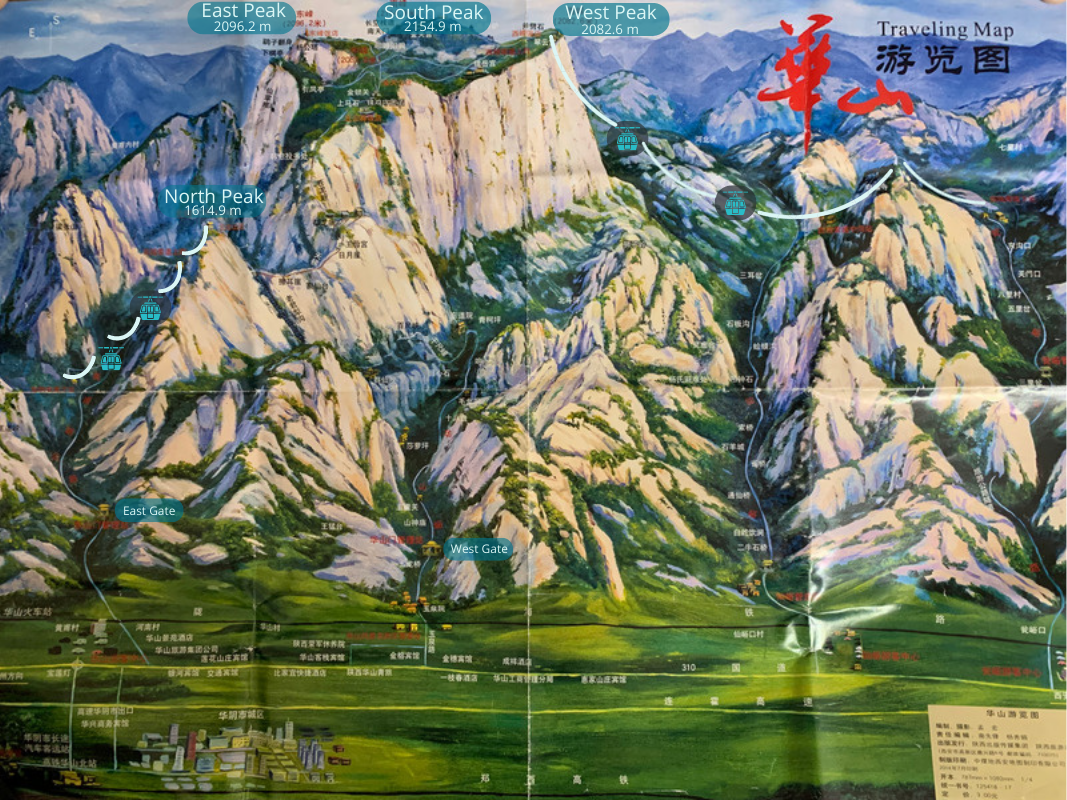
There are a few ways to get up Mount Huashan and this will be determined by how much hiking you want to do and which route you want to take. There are two cableways that are on opposite sides of the mountain that you can take, or you can decide to walk up.
West Peak Taiping Cableway
This cableway is further away from the town, the newer of the two and takes you directly to the summit of West Peak. Both cableways require a bus ride from the ticket entrance. So once you purchase your ticket, you’ll need to get on a 40-minute bus ride to the cableway. Then the ride in the cableway takes about 20 minutes.
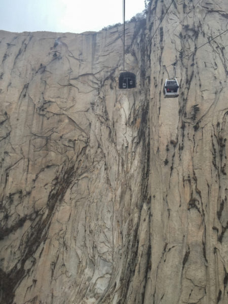
Take this one if you want to get to the highest summit faster and do less uphill hiking.
Cost: One-way ticket ¥140, Round-trip ¥280 (December-February ¥120/ ¥240)
Hours: 7am-7pm (8am-5pm December-February)
North Peak Sante Cableway
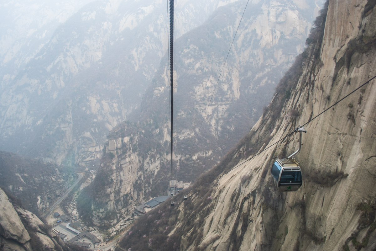
The North Peak Cableway is closest to Huayin and was closest to where we stayed. Similar to West Peak, you’ll need to make your way to the ticket entrance, then take a 20-minute bus to the North Peak Sante Cableway. The cableway here takes about 10 minutes.
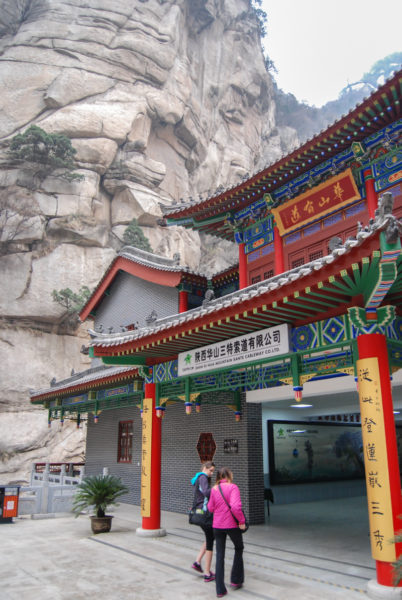
North Peak is the shortest peak, so you’ll be hiking up the rest of the way to the other peaks. So take this one if you want to do some more hiking.
Cost: One-way ticket ¥80, Round-trip ¥150 (December-February ¥45/ ¥80)
Hours: 7am-8pm (8am-6pm December-February)
Soldier’s Way
You could also take the Soldier’s Way up the mountain. The Soldier’s Way consists of 4,000 stairs and nearly 90° angled stairs by the way. It’ll add about 2 hours to your hike just to get to where the North Cableway takes you.
I considered doing this at some point because I really wanted to see the famous spot where there are two 90º angled stairs (and a normal path). Thank goodness my mom and sister had a firm ‘no’ on that one. We saw the path from the cableway and I was glad we took the ‘easy’ way up. Basically, instead of taking the north cableway up, you’ll be hiking under it.
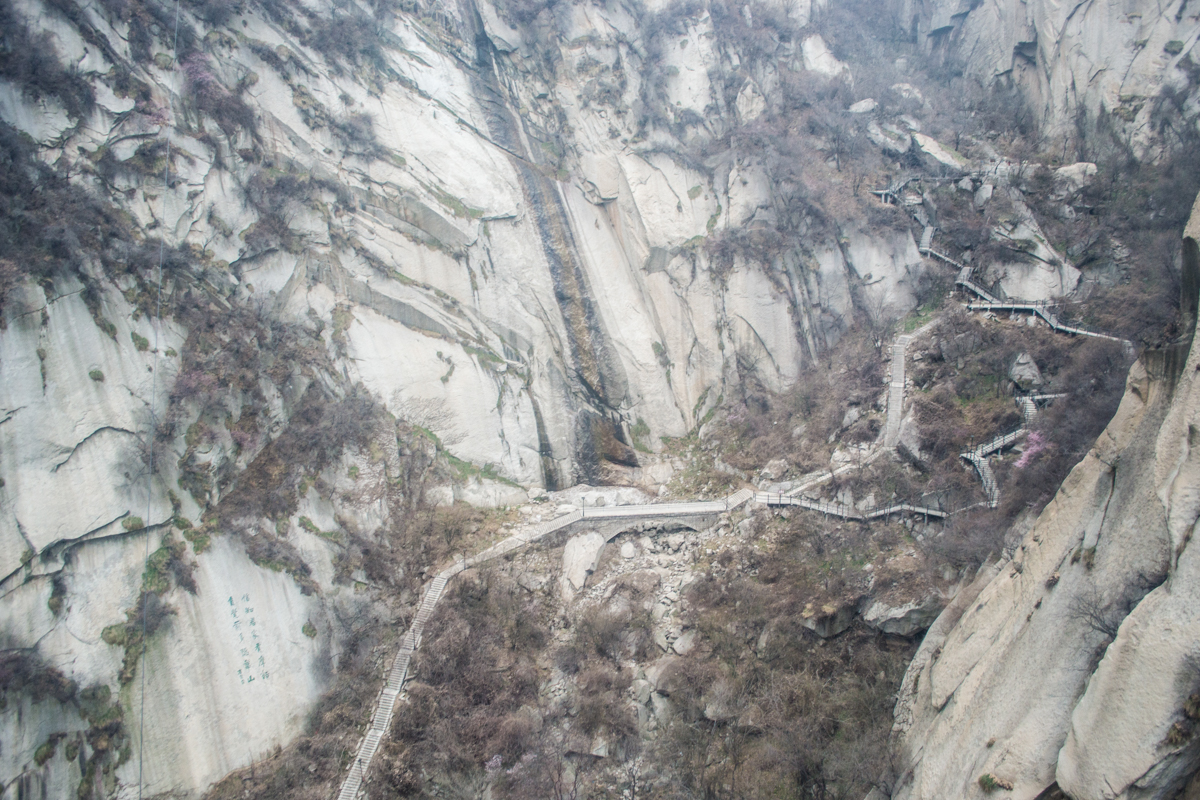
Here’s the thing, there are other places to see 90ºish angled stairs. And…you’re going to be hiking just as much just to get to the other peaks.
West Gate Hike
If you want to walk up and see a lot of the main sites, you can start at the West Gate Entrance near the Yuquan Temple. This walk takes you up to the North Peak area and allows you to see about 20 sites along the way. The downside–it will take you about 4 hours to walk this section and get up to the actual peaks.
Fees: General entrance to the mountain is ¥160 ($24) or ¥100 during December-February ($15). You’ll be paying an ADDITIONAL amount for each cable car you want to take–either one way or round trip.
Where to Go
The route you take largely depends on which way up the mountain you go. We decided to go up the North Peak cableway, hike across each peak from there and descend down the West Peak cableway.
(I read on one Chinese website that this was the most popular route and “doesn’t take too much physical strength and even the elderly can do this route”. LOL LOL. Please do not listen to that.)
North Peak
First off, taking the cable car up does not bypass the hike. It just takes you to a different section of the hike. It took us several hours just to get up North Peak because we kept stopping for pictures and exploring along the way. Once we got off the cable car and hiked over to the other peaks, it certainly felt like we had taken the Soldier’s Way up.
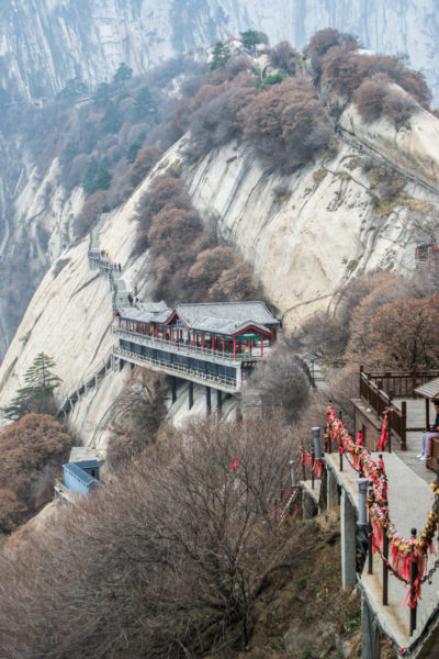
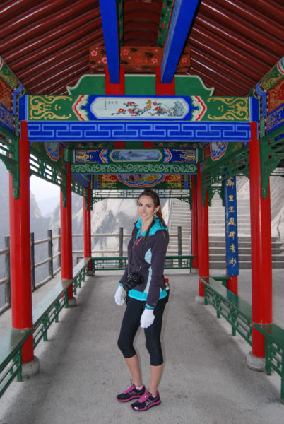
There were a few little stores on north peak but none of them looked like they had been open or restocked in 10 years. Most were not open when we hiked by them as well.
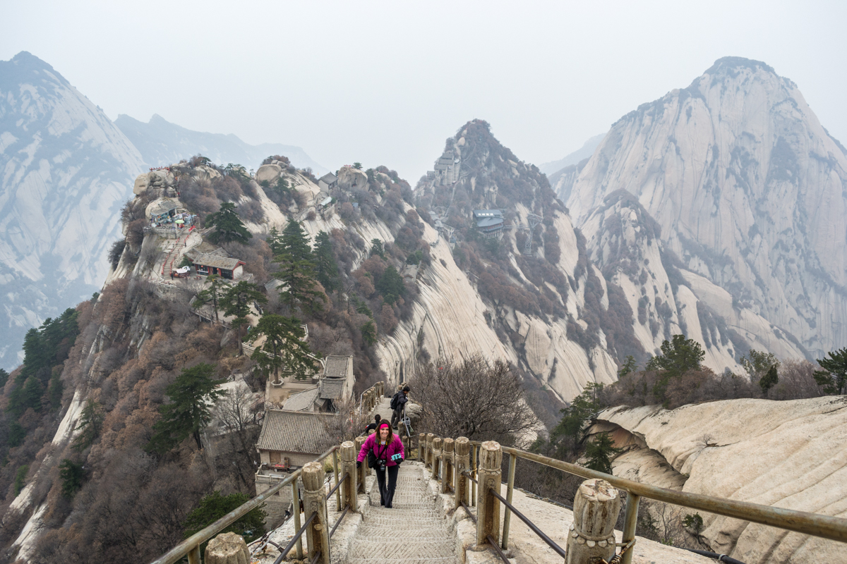
This section has things to see along the way and great views of the trail. It took us awhile to get through because there was lots to see.
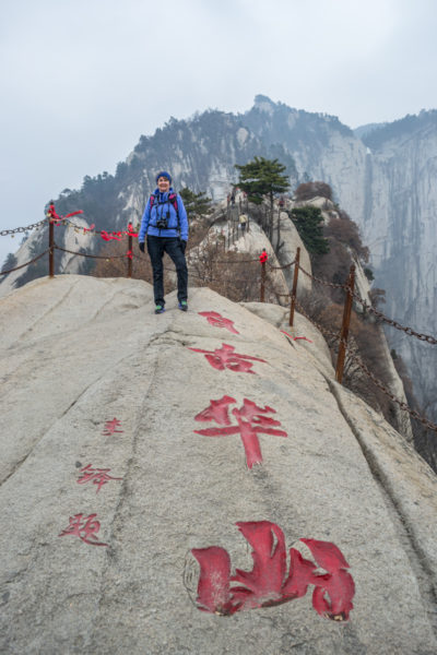
Central Peak
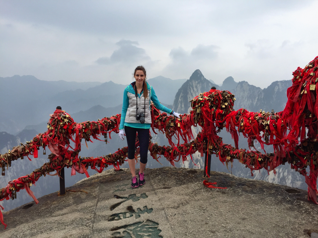
Central Peak is mostly an extension of East Peak or the bridge between North and East. Right before you get to the Central Peak, you’ll arrive at the Golden Locks Pass where you’ll see thousands of red ribbons and gold locks. It’s also known as the Gate to the Sky. The custom here is to pray for the health and safety of friends and family when attaching a lock.
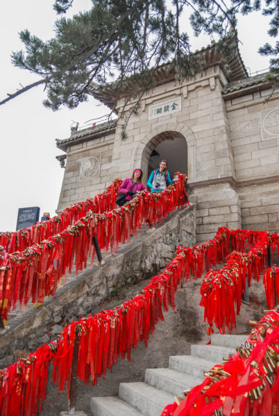
East Peak
When we got to East Peak, I thought my mom might die. At one point she sat on the stairs and told us to just leave her there. That this would be her final resting place or that she’d eventually find the other cable car down. (China really tests people.)
We convinced her to go to the next fork and thank goodness we ended up somewhere on top of a peak with some flat areas to rest.
East Peak is actually where you can do another dangerous hiking trail which is often overlooked in comparison to the Plank Walk. The Chess Pavilion hike has similar elements in that you’ll be harnessed up and part of the hike will be drop offs and pegs or rock holes for footing.
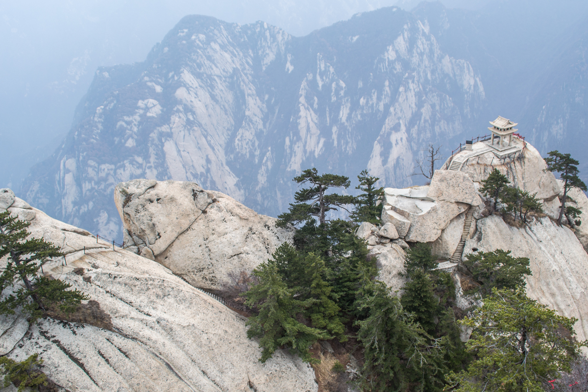
It takes you along a dangerous path where you’ll be unhooking your carabiners on steep slopes and skinny pathways. At the end is a small pavilion with a rock slab table. According to legend, an emperor had played chess here with a sage–quite the location!
We explored a bit, took some pictures, rested some more and eventually made it over to South Peak, where the infamous Plank Walk is located.
South Peak
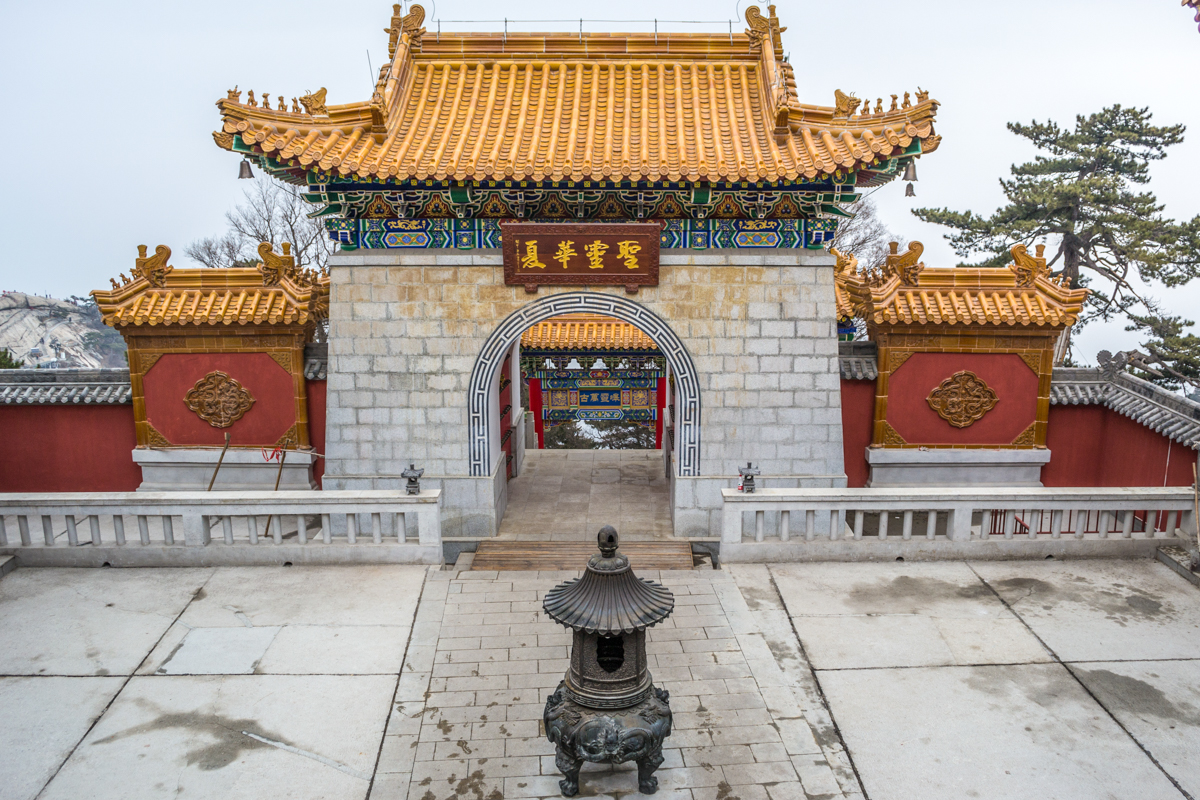
The South Peak is the highest of the peaks at 2155m and where you’ll want to go if you want to hike the Plank Walk. There are several temples on this peak that you can walk through also.
The Plank Walk at Mount Huashan
The Plank Walk was built by a Taoist priest over 700 years ago. It’s an entirely optional hike on Mount Huashan and fairly short. It’s only about 330 feet long (100 meters) but takes longer to do because of how dangerous it is. In fact, it’s rumored that the Plank Walk is responsible for about 100 deaths per year.
Somehow I convinced my sister to do the hike with me while my mom got chased off by a monk for taking pictures. After so much internet hype and speculation, I was excited and nervous to hike it myself.
So what’s the Plank Walk actually like?
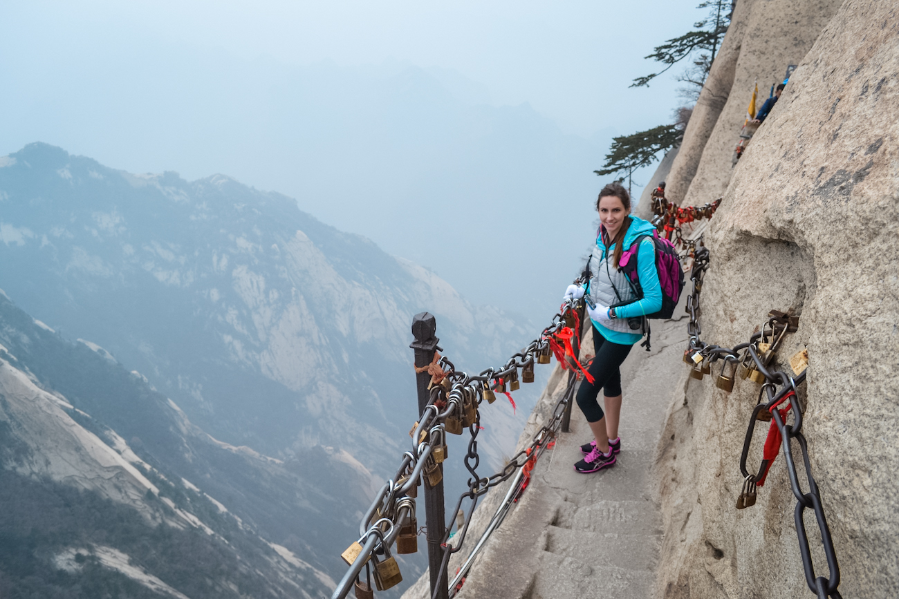
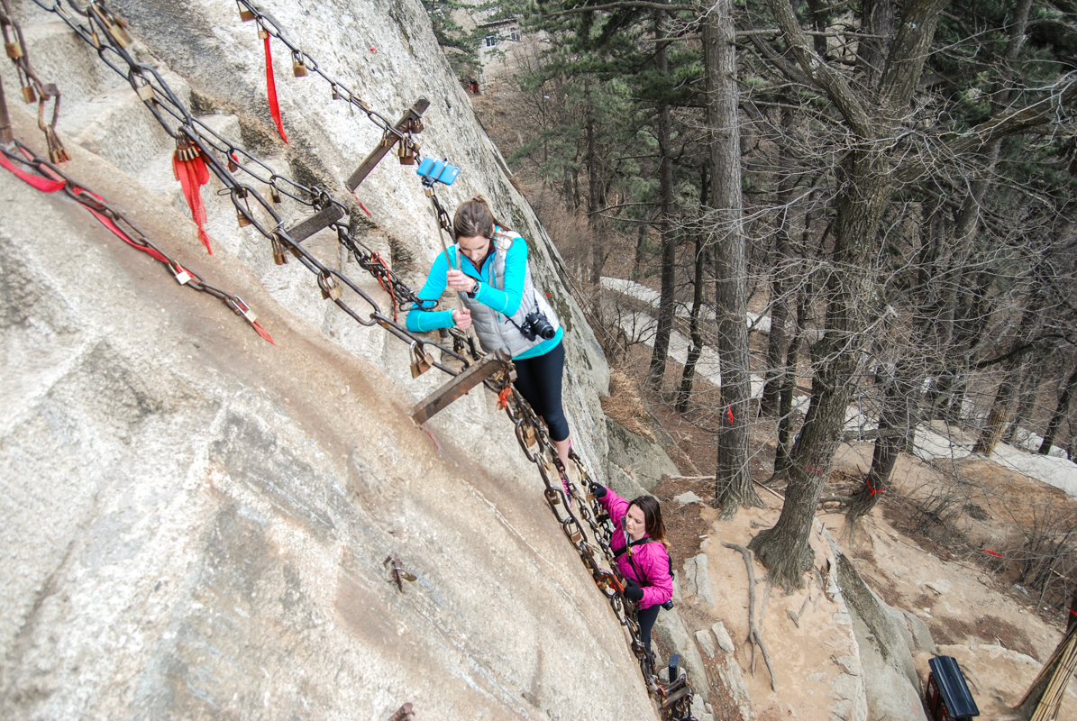
Once you get to South Peak, there is a vertigo-inducing path on the edge of the mountain. It winds you around to the start of the plank walk. After you pay ¥30 ($5.00), you are handed a small harness to go over your shoulders and 2 carabiners.
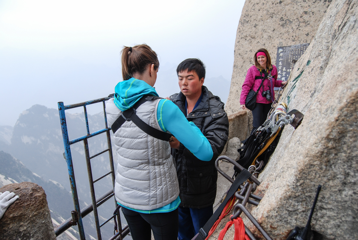
In March, the weather is still very cold. So, you can choose to wear potentially slippery gloves or withstand the blistering cold metal with bare hands. After you strap in and secure your carabiners, you can begin your decent down the stairway of nothingness. Meaning that between two slabs of rock, thin metal rods were somehow placed and either wedged/welded to the rock. Below these “stairs” is…nothing, except the valley floor hundreds of feet below.
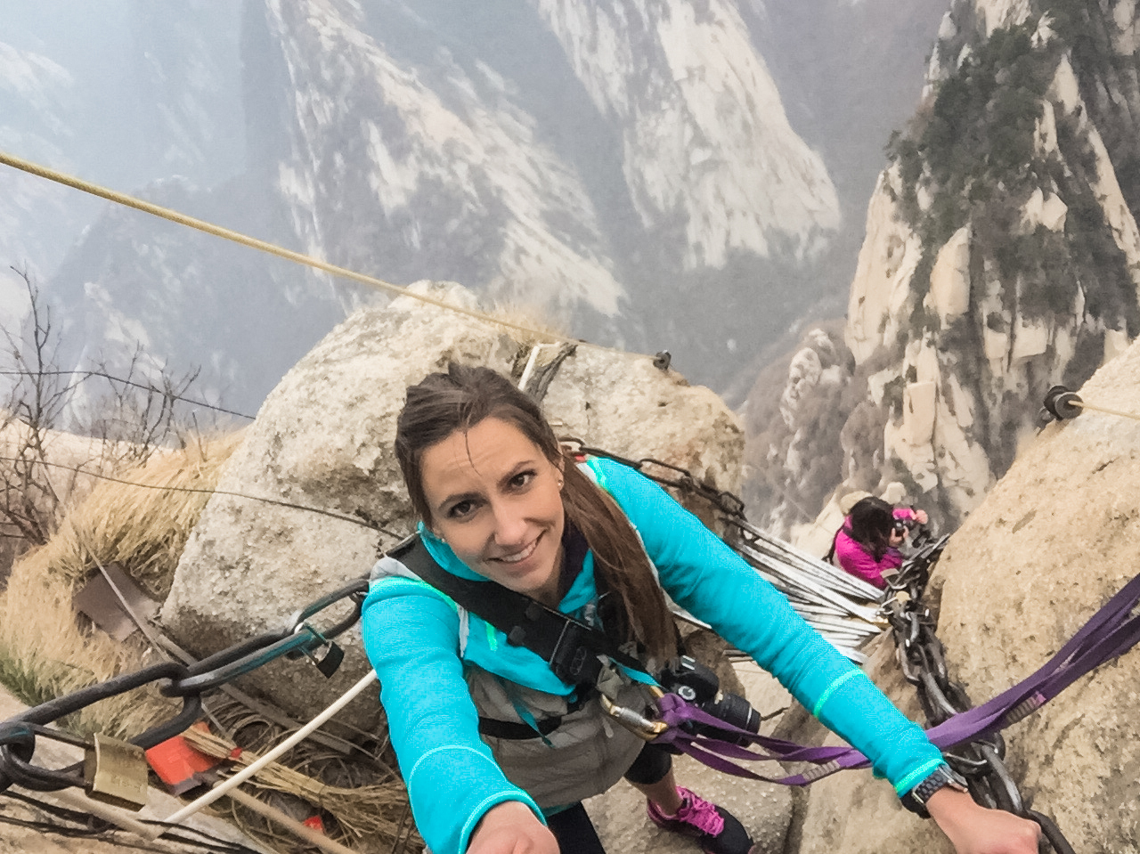
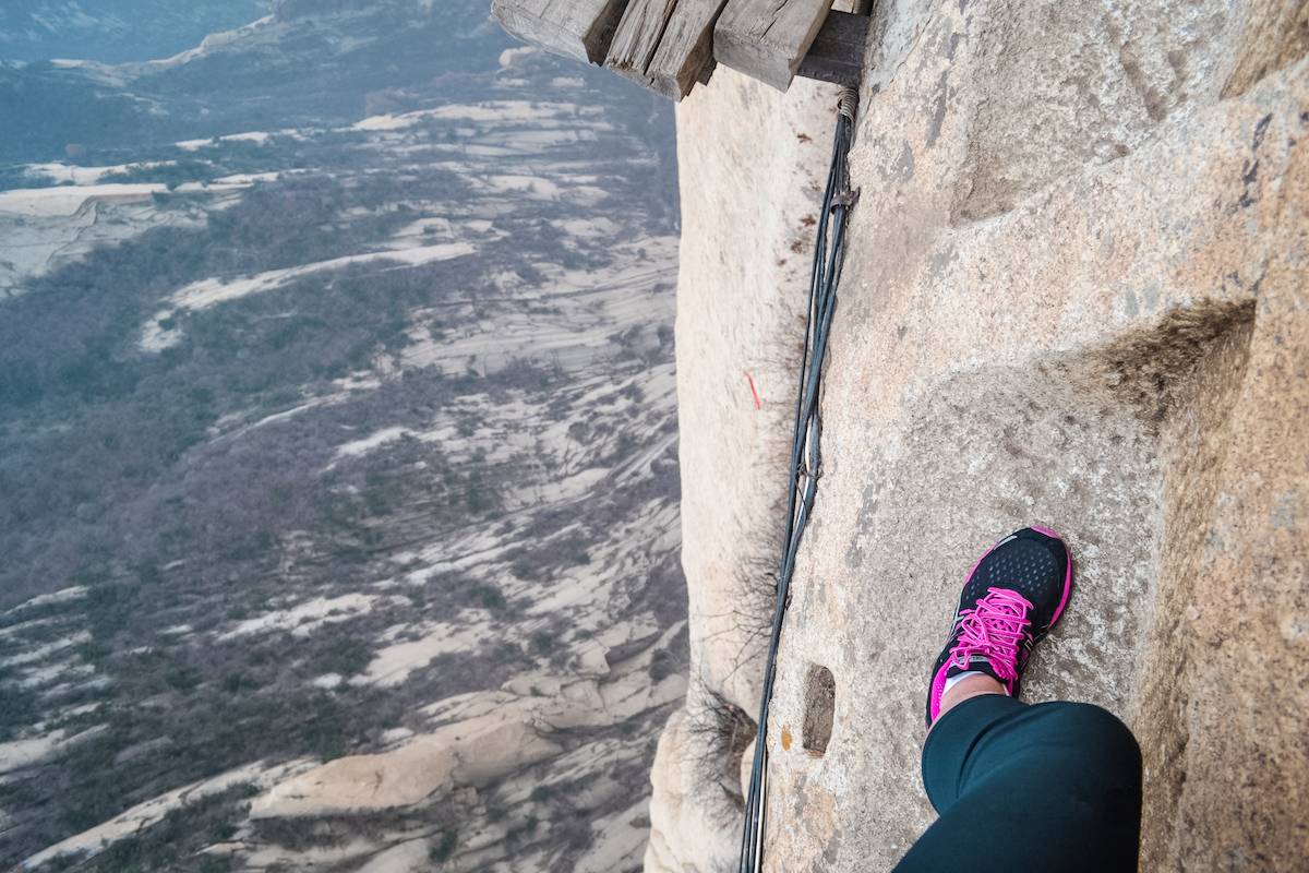
Next, you will come across some foot holes that have been carved into the mountain which will cause you to wonder:
Who in the world put these here in the first place? And how?
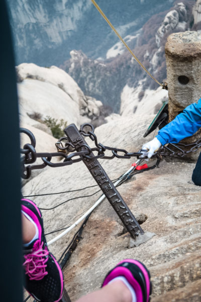
But you don’t ponder it for long because you are about to step on your first plank. Your hands are shaking and your legs feel like lead as you fumble over the first few chains between vice-like grips.
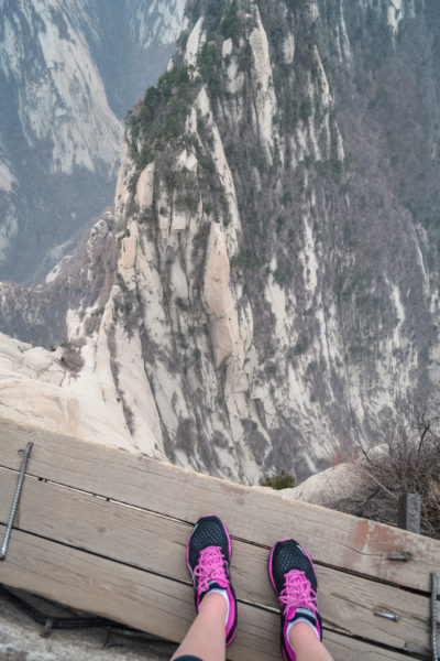
After a few deep breaths and some pictures, you start to feel a little more comfortable living on the edge. You take a few more and advance further along.
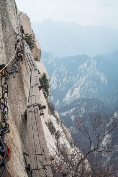
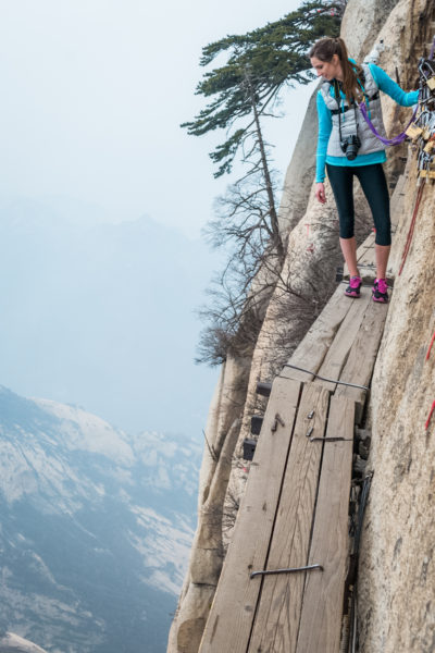
The more you look down into the valley, the more comfortable you begin to feel. You attempt to maneuver cameras and selfie sticks because there is no way that you are leaving without proper documentation.
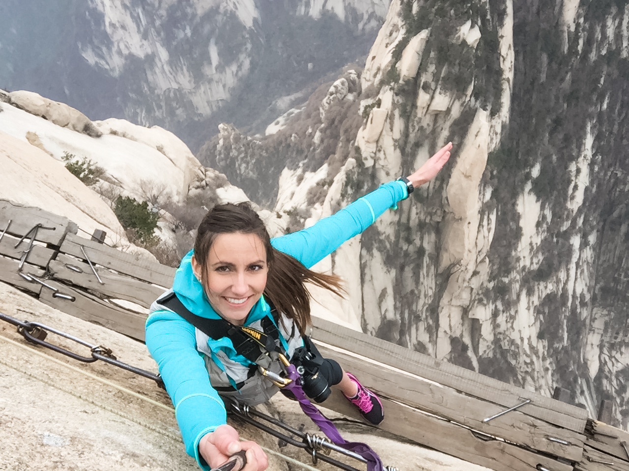
The end?
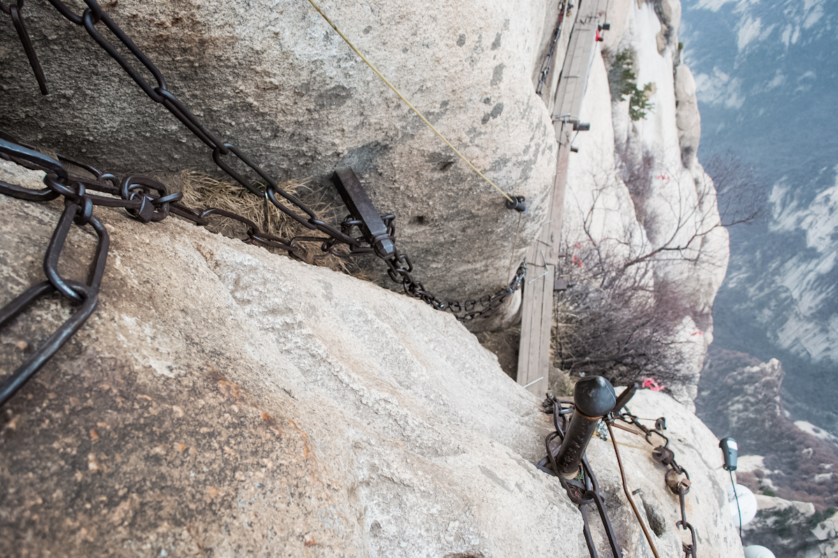
After about 15 minutes, you reach the end of the planks and ascend up similar stairs to the beginning. At the top of the stairs, you unhook your carabiners and step out onto a small dirt landing. You take a deep breath of accomplishment. You stretch out your legs and look into a hole in the mountain that holds a statue and a pillow to kneel on. There are still a few sticks of incense burning from whoever was there last. This isn’t exactly what you were anticipating but you snap a quick picture anyway.
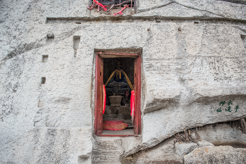
You are ready to move on–relieved that you have made it to the end, except that…it’s not the end. There is nowhere else to go, so you turn around to go back where you came from because the Plank Walk is
A. TWO. WAY. PATH.
While the way there was relatively devoid of people, the way back is becoming more congested. You start to near some people who have just stepped foot on the Plank Walk and you both hesitate until it resonates. Someone will have to BEAR CRAWL around the other.
One look in their eyes tells you they sure as hell aren’t going to be the one to go around you. They hug the side of the mountain and you reach around them to move your carabiners. Then you step on the outside of them–your body hanging over thin air. You repeat this process several more times as the amount of people continues to increase.
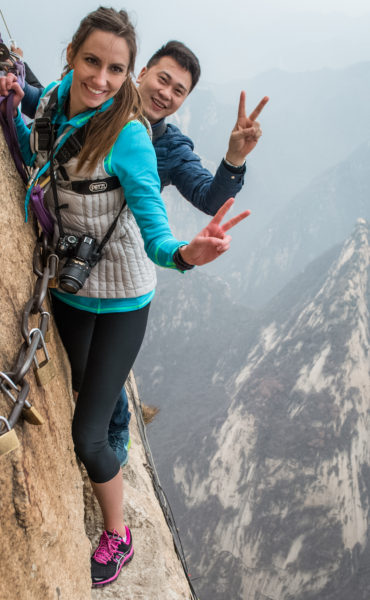
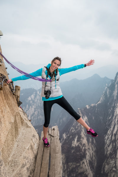
You reach the final “stairs” (the metal rods) and wait for a break in the crowd. After several minutes, you realize the faucet of people coming down is not going to let up. You take a breath and begin to bear crawl over top several people which ends up looking like a game of Twister on the edge of the world.
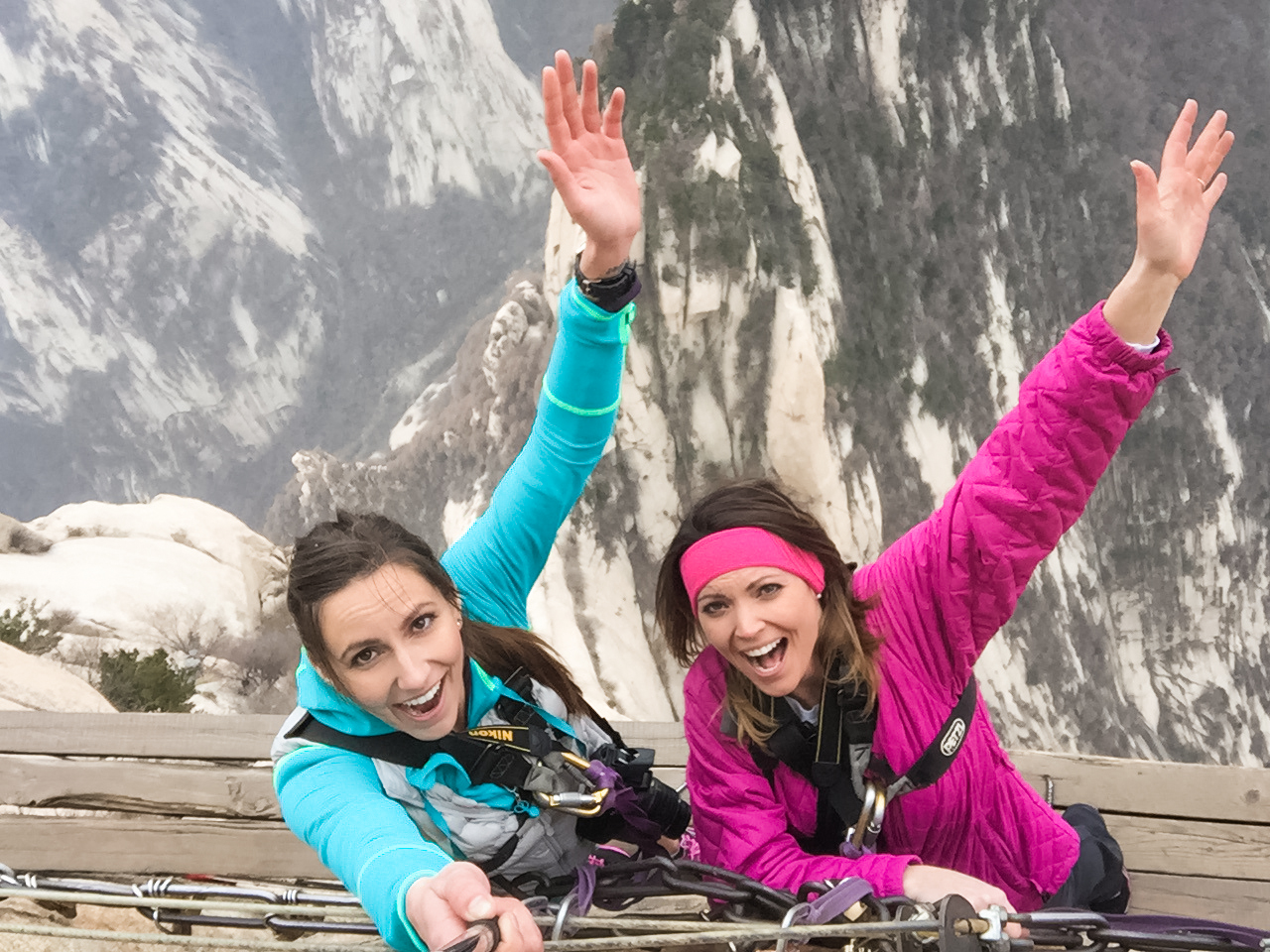
As you reach the top and return your harness, you are a mixture of fatigue from climbing all day, excitement from having completed something so thrilling and relief from having survived it all.
So, there you have it.
It’s completely optional, absolutely insane and does not lead you to a tea house on the edge of the cliff. (You can, however, do the Chess Pavilion hike to pretend to play chess on the edge of a cliff.)
!! Important Info: Changes have been made since we hiked the Huashan Plank Walk. Apparently unhooking your carabiners to bear crawl over people on a set of metal rod stairs is no longer considered safe. They are now allowing people to hike it in groups so that there is no longer two-way traffic on the Plank Walk. You’ll likely hike to the dirt section, wait for everyone else to get there, and then return.
Since you’ll have to wait for groups to finish, the lines (and waiting) will likely be much longer.
West Peak
The West Peak has some sheer drop offs near part of the trail. The views are beautiful and the rocks large, so you don’t necessarily have to be right up on the edge if you don’t want to be.
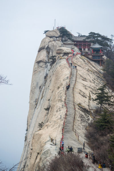
Here is where you’ll find the West Peak Cableway to get you back down the mountain (or where you’ll come up). It’s the newer of the two, likely busier and pretty steep. It has a 40-minute bus ride to the cableway from the ticket entrance.
When we came off the mountain, we were beat, starved and haggard looking.
Now…there’s some confusion here. Once we got off the cableway, there were stairs after stairs that we climbed down–literally hundreds.
I DO NOT KNOW HOW WE WENT FROM THE WEST PEAK CABLE CAR TO THE WEST GATE ENTRANCE.
It literally does not make sense on any map. But HERE WE ARE AT WEST GATE and I have no idea how we got there. The 40-minute bus takes you down to a separate entrance and we did not get on it because it was really far from where we needed to be. Somehow we traversed across more trails to get there, though it looks impossible on a map.
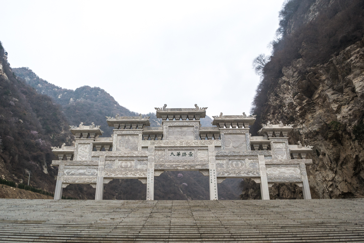
When we got to the West Gate entrance, we miraculously ran into our stranger friend who brought us to the mountain that morning. We must have looked like we were in an absolute state of misery, because he brought us to the employee quarters where he gave us more snacks!
He pointed us towards a bus that would take us back to the tourist center. All I know is that we were on A bus and that my sister bought a dozen boiled eggs on the way down because food options were limited and ate them all on the ride back. lol
Popular Mount Huashan Routes
If you’re wondering which route to take, here’s a quick rundown of what to expect for each route.
From North Peak to West Peak
This is the route we took and we ended up doing A LOT of hiking. You’re taking the cableway up to the lowest peak and then hiking to the highest peak. I don’t regret going this way–it was a struggle but definitely worth it and not very crowded.
From West Peak to North Peak
On this route, you’ll be taking the other cableway up to one of the higher peaks, so you’ll be closer to the summit. You’ll still be doing some uphill hiking since South Peak and East Peak are slightly taller. But you’ll be going downhill for several parts to get to North Peak, which is the lowest.
Contrary to what I read online, I feel like this is the most popular route since you’ll still be doing some hiking, but it might be a bit easier on the legs.
Up West Peak and down West Peak
Another option is to get a roundtrip cableway ticket for West Peak. You’d be hiking around the South, East, Central and West peaks and then returning back to the cableway. While there’s plenty to see on the rest, I do think that North Peak has some great vantage points of the trail that you’d miss out on.
Weather on Mount Huashan
China is notorious for its smog but you have a better chance of having a blue sky at places like Mount Huashan. As if mirroring my entire year in China, our day on the mountain was also smog-filled (or cloudy…it’s always hard to tell).
Whether you visit in the summer or winter, you’re still heading up a mountain. You’ll want to prepare for cooler temps regardless of the season, especially if it’s windier. Bring layers for the summer and dress warm in the winter.
We visited in March and we were drastically underprepared. The weather was very cold and we were pulling out every extra layer we could muster–hence why my entire outfit is random and mismatched. I was wearing my mom’s vest, some random oversized gloves we found…
What to Bring:
- Snacks. And if you’re hiking early, make sure you get snacks the day before. There were several restaurants and stores on the mountain, but hardly any of them were open when we went. We were withering away by the end.
- Water.
- Good Hiking Shoes. You’ll want comfortable shoes because you will be walking a LOT.
- Non-slip gloves depending on the season and for sweaty hands on the plank walk. You’ll want a firm grip on some of the cold chains along the trails.
- Layers. Even if you’re hiking in the summer, you might want to have layers in case it’s cooler and windy at the top. If you go during the winter or surrounding months, definitely bring warm clothes.
- Sunscreen if it’s sunny/clear. Rain jacket if it’s rainy.
- Small backpack
- Camera
Where to Stay
On the Mountain
I didn’t know this at the time, but apparently you can actually stay ON the mountain. When we were hiking around, everything was in mandarin so I had no idea what the buildings were that we saw.
There are several small hotels on the peaks that offer basic accommodation, though most are dorm style and considered to be pretty poor accommodations. But you could potentially stay here if you wanted to be on the mountain for sunrise/sunset.
They don’t show up on regular hotel booking sites so I have no idea how you would go about booking them.
Huayin
If you plan on staying the night in Huayin, I would choose a hotel that is as close to one of the mountain entrances as you can get. Otherwise, you may have to hitchhike like we unintentionally did.
One thing about staying in Huayin though, is that apparently a lot of places turn off their electricity at a certain time of night and back on in the morning. We tried (and failed) to catch an early bus and we had zero electricity to pack our bags. So, we went down to the front desk to see if we could get any answers and the girl was asleep by candlelight.
We packed by the light of our phones and dragged our suitcases halfway across town (since again, there were no taxis that early) to a bus depot that was no longer operating.
Things to Know
Where do I begin? This is the section where I want to warn you of traveling through China, especially to more remote areas, but there’s nothing I can say that will ease the pain. It might help you mentally prepare but unless you plan on going on a tour, buckle up for a rough ride.
- This is a pretty remote area for foreign tourists. There is little to no English spoken here so we had to pull out all the charades, and when that didn’t work, our drawing skills.
- There are some English signs on the mountain, but not everywhere. They also didn’t have any English maps at the ticket entrance when we were there, so we were navigating with a map in Chinese symbols.
- Most of the time we were hiking here, we had no idea where we were unless we were at a main landmark. There are so many nooks, paths and buildings to see that you can easily lose track of where you are or even what peak you’re on.
- Make sure to keep track of time. If there’s specific hikes you want to do, like the Plank Walk, make sure you have plenty of time to get there AND plenty of time to get to the cableways before they close.
- The Plank Walk and other dangerous trails may be closed if there is bad weather on the mountain.
- Good luck!
PIN IT FOR LATER





Wow! The closest I will come to the plank walk is this blog post! The pictures alone have my hands sweating! Really! This does look like an incredible adventure and once in a lifetime hike–I have some adventurous people in my life that would love it. Thanks for sharing all the helpful information–this is definitely a hike you need to plan well for!
OMG, I loved this post! I am terrified of heights and went weak in the knees just looking at your pictures. So… I’m glad you shared this experience as I will never do it!
How cool… but I can definitely never do this! ha I can barely handle stairs with spaces between each step, let alone THIS! Way to go! I’m just going to vicariously live through you and your pictures on this one lol
haha it was definitely a crazy experience! I felt much more at ease with a harness on!